Floodwaters in southern Colorado surge 7 feet inside homes
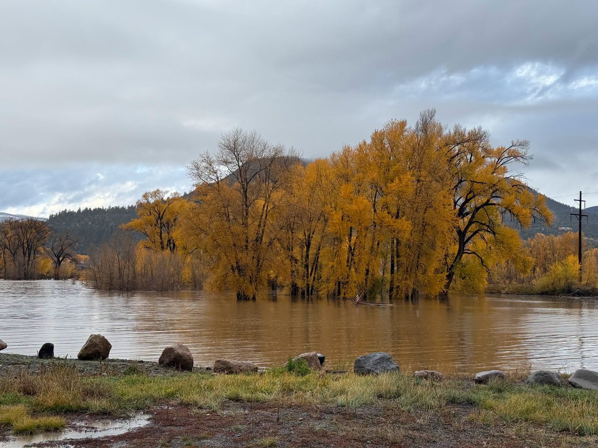
Parts of southern Colorado are recovering from major flooding caused by ongoing storms this week, with reports of 7-foot-high flood waters inside houses along the Conejos River in the San Juan Mountains and flood waters rising 4 to 5 feet in homes in the South Fork area.
Gov. Jared Polis on Thursday night verbally declared a disaster emergency due to flooding in much of southern Colorado, including in La Plata, Archuleta, Montezuma, Dolores, Hinsdale, San Miguel, Ouray, San Juan, Mineral, Alamosa and Rio Grande counties, according to a statement from Polis’ office.
Polis on Friday evening added Conejos County to the list of affected counties. The state is also working with the Southern Ute Indian Tribe to respond to flooding on tribal land.
The governor’s declaration activates Colorado’s emergency operations plan and cues the Colorado National Guard to prepare to respond, help evacuate residents and begin search and rescue.
“As of this morning we had about 1,000 families evacuated,” Polis told The Colorado Sun Friday afternoon. “We won’t begin to know the exact level of the damage until we’re able to get back into some of the severely flooded areas.”
By Friday evening, an additional 100 people were actively being evacuated, according to Polis’ office.
Once the floodwaters recede, officials will be able to enter, document and assess damage. These assessments help the state determine whether it needs to request additional support from the federal government to help impacted communities.
“We’re going to be on the ground there doing everything we can to ensure the safety of the people and to document any losses so that people can get their claims,” Polis said.
The flooding has not led to any injuries or deaths but has forced evacuations in an estimated 80 to 100 homes in the South Fork area of Rio Grande County, according to Linette Nye Schmidt, spokesperson for South Fork Fire Rescue.
South Fork is at about 8,200 feet in elevation along U.S. 160 west of Del Norte and sits at the confluence of the South Fork and Rio Grande rivers.
Mandatory evacuations around South Fork along the Rio Grande began Thursday with water levels on the rise and floodwaters in low-lying neighborhoods. Those evacuations remain in effect, Nye Schmidt said, and 15 people stayed Thursday night at the South Fork Community Building.
“We have teams going out to do damage assessments,” she said Friday morning. “We started to recede some, but it’s very slow to recede.”
South Fork Fire Rescue also reported a missing bridge, Park Creek Bridge, that extended over Forest Service Road 380.
“As far as we know, everything else is still intact,” Nye Schmidt said, “but whether they’re safe is being assessed.”
Emergency crews are working on bringing heavy equipment into flood zones to start clearing debris from roadways. Sections of U.S. 160 to the east and west of Pagosa Springs remained closed Friday morning.
U.S. 550 is also closed in both directions between South Mineral and County Road 31, 4 to 9 miles north of the Silverton area, because of flooding.
Additionally, a 38-mile stretch of Colorado 17 remains closed from Antonito west to the New Mexico border because of flooding and safety concerns, the Colorado Department of Transportation said.
South Fork Fire Rescue is urging anyone who is not a resident or a first responder to stay out of the area after people from outside the community wandered in to check out the flooding, Nye Schmidt said.
“We need them to stay out of the area,” she said, “both for their safety (and) responder safety and to ensure that the crews have access to the areas so that they can do the assessments and then make sure everybody’s out.”
Meanwhile, in Durango, the Animas River flow readings past Santa Rita Park were at 9,850 cubic feet per second Friday morning, up from around 1,170 cfs Wednesday evening because of ongoing storms in the area. Its height increased to nearly 8 feet Friday from around 3.5 feet Wednesday.
The La Plata County sheriff closed the Animas River to all watercraft Friday, including paddleboards, kayaks, canoes, rafts and similar vessels. The river will reopen when conditions allow safe use, according to a La Plata County news release Friday.
“We’re working with the local sheriff’s office in the counties that are affected,” Polis said. “We’re doing everything we can as we get through this difficult time.”
Previous hurricane in eastern Pacific Ocean triggered floods
Storms that began on Wednesday were the major force behind the floods. The rainfall washed over southern Colorado as “remnants” from Hurricane Trudy brewing in the eastern Pacific Ocean, according to Brooke Scholtens, a meteorologist with the National Weather Service in Grand Junction.
That tropical system has weakened and is no longer a named hurricane.
That storm, coupled with winds blowing from the southwest, created the right conditions for flooding in Colorado, Scholtens said.
“When that happens, it’s kind of a favorable or perfect setup for the Four Corners to receive a large amount of rain,” she said.
Preliminary totals of rainfall measured around 5.05 inches in Pagosa Springs, 3.06 inches in Durango and 3.27 inches in Bayfield. The precipitation has caused surges in the San Juan River at Pagosa Springs — which crested at 15.02 feet Thursday around 5 a.m. — and the Animas River near Durango. That river peaked at about 8.1 feet around 10 a.m. Thursday.
How do 3 to 5 inches of rain lead to dangerously high rivers?
A big part of the answer is where the rivers flow, Scholtens said, explaining that the rivers originate in places upstream from the flood impacts.
Both rainfall upstream and rainfall from the sky will increase the river flow as it moves downstream and will increase water levels throughout the river.
“We have the origin of the rain in a lot of the San Juan Mountains and so that will flow down tributaries, which are the rivers that go into towns like Pagosa Springs,” she said. “And so as that water is flowing down those tributaries, it will pick up more rainfall from the sky and from other tributaries and that will contribute to its flow. And then that flow moves toward places like Pagosa Springs, picking up even more rainfall as it moves downstream.”
Snow up in the mountains exacerbated flooding, said Stephen Hodanish, a meteorologist with the National Weather Service in Pueblo.
Rain fell on the snow, which then melted, at a time the ground was already saturated from a storm about a week ago, Hodanish said.
“Things all came together to produce moderate to severe flooding in the San Juans,” he said.
Southwestern Colorado isn’t quite in the clear from rain clouds just yet. The forecast shows a chance of rain hanging on through Saturday and into parts of Sunday before drier weather is expected to move in the first half of next week.
There is a glimmer of good news within the gloomy forecast: water in a year defined by a stubborn drought.
“The bad news is there’s flooding,” Hodanish said. “The good news is it’s bringing much, much, much beneficial moisture that we desperately need, but it’s kind of bringing it all at once. I feel sorry for the folks who are receiving damage due to the flooding, but we desperately need this moisture.”