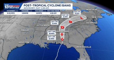
Alabama’s weekend weather forecast cooler after Isaias passes
The remnants of Isaias will keep the weekend cloudy, breezy, and cooler before next week gets hot and dry again. Check the video forecast for the latest updates.
LIVE COVERAGE HERE
7-DAY FORECAST
SATURDAY: Morning rain and wind easing in the afternoon. Occasional showers and a southeast breeze in the afternoon and evening. Temperatures in the upper 60s to lower 70s. Rain chance: 80%.
SUNDAY: Partly to mostly cloudy. A light breeze with a few spotty showers early. Highs in the upper 70s to lower 80s. Rain chance: 20%.
MONDAY: Fair and cooler in the morning. Still very warm in the afternoon. Highs in the 80s. Rain chance: 0%.
TUESDAY: Partly to mostly sunny. Unusually warm and dry in the afternoon following a mild morning in the upper 50s to lower 60s. Expect high temperatures around 84-88 degrees. Rain chance: 0%.
WEDNESDAY: Fair and warm. Morning lows in the 60s, afternoon highs near 90 degrees. Rain chance: 0%.
THURSDAY: Sunny, unusually warm and dry. Morning lows in the 60s, afternoon highs near 90 degrees. Rain chance: 0%.
FRIDAY: Increasing clouds. A low chance of some showers ahead of a cold front. Highs in the 80s. Rain chance: 10%.
SATURDAY: Breezy and cooler. A cold front drops temperatures back to near or just below average for mid-October. Highs in the 70s. Rain chance: 10%.
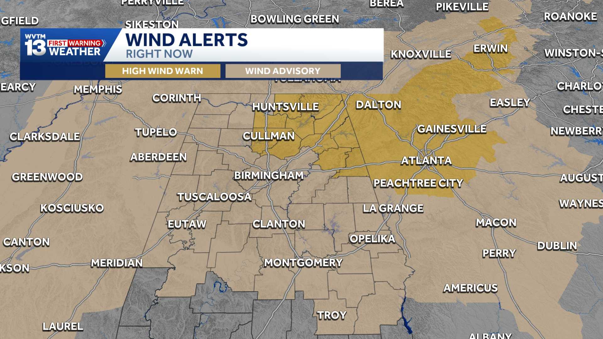
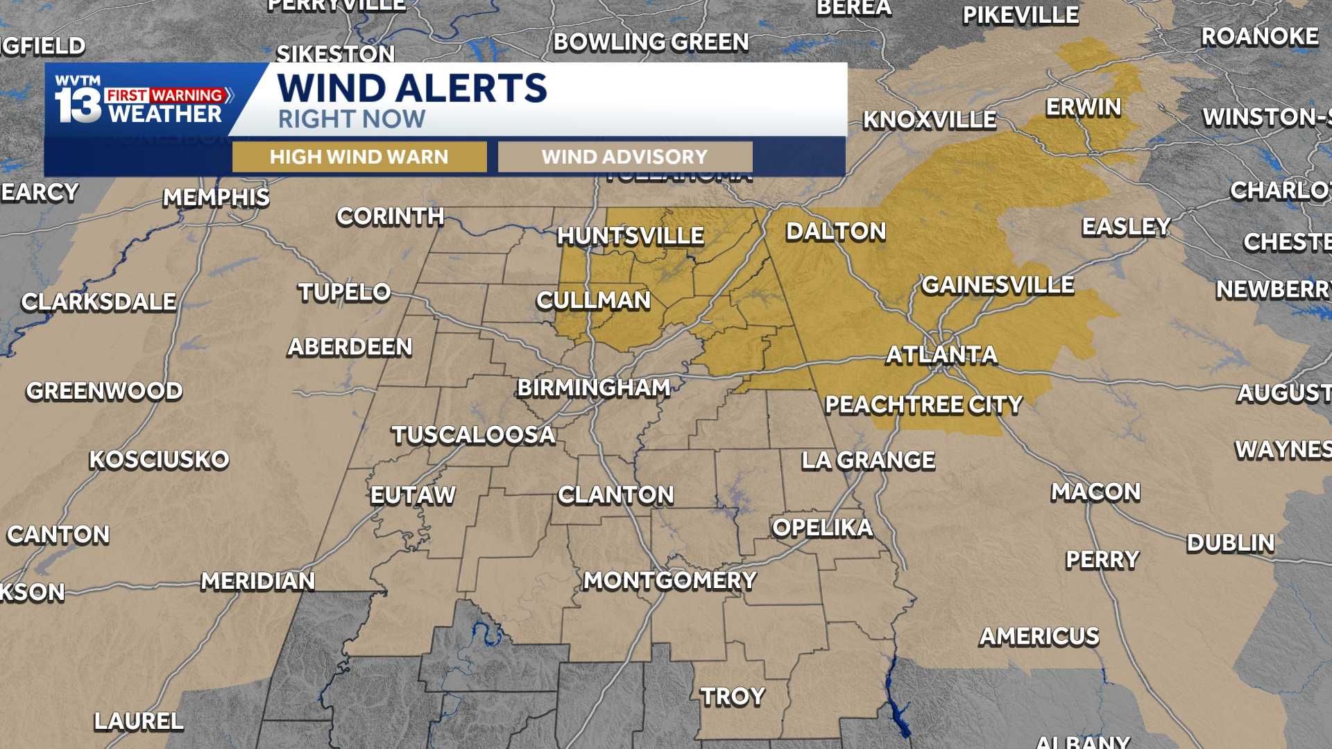
WIND ADVISORY
A Wind Advisory is in effect until 7 PM CDT. Expect southeast winds of 15 to 25 mph with gusts reaching up to 45 mph across Central and West Alabama. Gusty winds may blow down trees, knock over unsecured outdoor items, and cause isolated power outages. Secure loose items outdoors!
SATURDAY AND SUNDAY
Good news for those attending the Alabama game Saturday evening: the worst of the weather will be long gone. You can still plan on a damp, gray evening, with a few spotty showers possible. Temperatures will be in the upper 60s at kickoff, then fall to near 63 by the end of the game.
Isaias’ impact will have the headlines for Saturday, but the weather will improve into Sunday. Spotty showers may linger early in the morning, but clouds will gradually clear through the afternoon. It will remain breezy, with wind gusts around 20 mph.
LOOKING AHEAD
By Monday, that tropical moisture will move out of the picture, and we will see another week of mild mornings and unusually hot, dry afternoons under a mostly sunny sky. High temperatures will rebound to the middle and upper 80s, and there will even be a chance some spots mainly over western Alabama could hit 90 degrees next week.
There are some signs of a strong front that will break the back of the unusual warmth by the end of next week.
October is running 8.4 degrees above average right now, and Birmingham has not had a single day with a high below 85 degrees. Hurricane Isaias will break that string of 80s and 90s, but it will get hot again afterward until that front can get here in about 7 to 8 days.
For 12 consecutive years, WVTM 13 First Warning Weather has been the source for the certified most accurate forecasts in Central Alabama, showcasing an unwavering commitment to delivering dependable weather updates.