
Cool mornings, warm afternoons and a Gulf tropical disturbance
Showers move out, and Alabama’s weather forecast stays sunny and warm this week
Drier air will set up more comfortable mornings for the new work week, but afternoons will still be much warmer than average. We are also tracking the potential for another widespread chance of rain next weekend. Check the video forecast for the latest updates.
7-DAY FORECAST
MONDAY: Mostly cloudy through mid-morning. A few showers lingering, especially over southeastern Alabama early in the day. Gradual clearing from north to south through the afternoon. Highs in the lower to middle 80s. Rain chance: 10%.
TUESDAY: Partly to mostly sunny. Warm and dry in the afternoon following a mild morning in the upper 50s to lower 60s. Expect high temperatures around 82-87 degrees. Rain chance: 0%.
WEDNESDAY: Fair and warm. Morning lows in the 50s, afternoon highs in the middle to upper 80s. Rain chance: 0%.
THURSDAY: Mostly sunny and warm. Highs in the upper 80s. Rain chance: 0%.
FRIDAY: Becoming more humid. Still very warm in the afternoon with a partly sunny sky. Highs in the middle 80s. Rain chance: 10%
SATURDAY: Increasing clouds. Warm and humid. Highs in the 80s with a chance of some rain depending on how a tropical disturbance in the Gulf tracks through the weekend. A small change in the track could bring a soaker or miss us completely. This will be refined as it becomes clearer. Rain chance: 40%.
SUNDAY: Mostly cloudy. Showers and some thunderstorms are possible based on the track of a Gulf disturbance. Small shifts in the path can lead to big changes in rainfall. This will be refined as the situation becomes clearer. Rain chance: 40%.
CLOUDS LINGER MONDAY
Muggy air slowly retreats on Monday behind a cold front accompanied by dense cloud cover. A few sprinkles remain possible as the front pushes south, but humidity will steadily drop through midweek.
The front will gradually push the humid air southward and bring back sunshine by afternoon. Highs will reach the low to mid-80s with a light north-northeast wind.
Mornings will become more comfortable Tuesday through Friday. Temperatures will drop into the mid- to upper 50s by sunrise, but the dry air will warm quickly, with afternoon highs returning to the 80s.
TRACKING A GULF DISTURBANCE
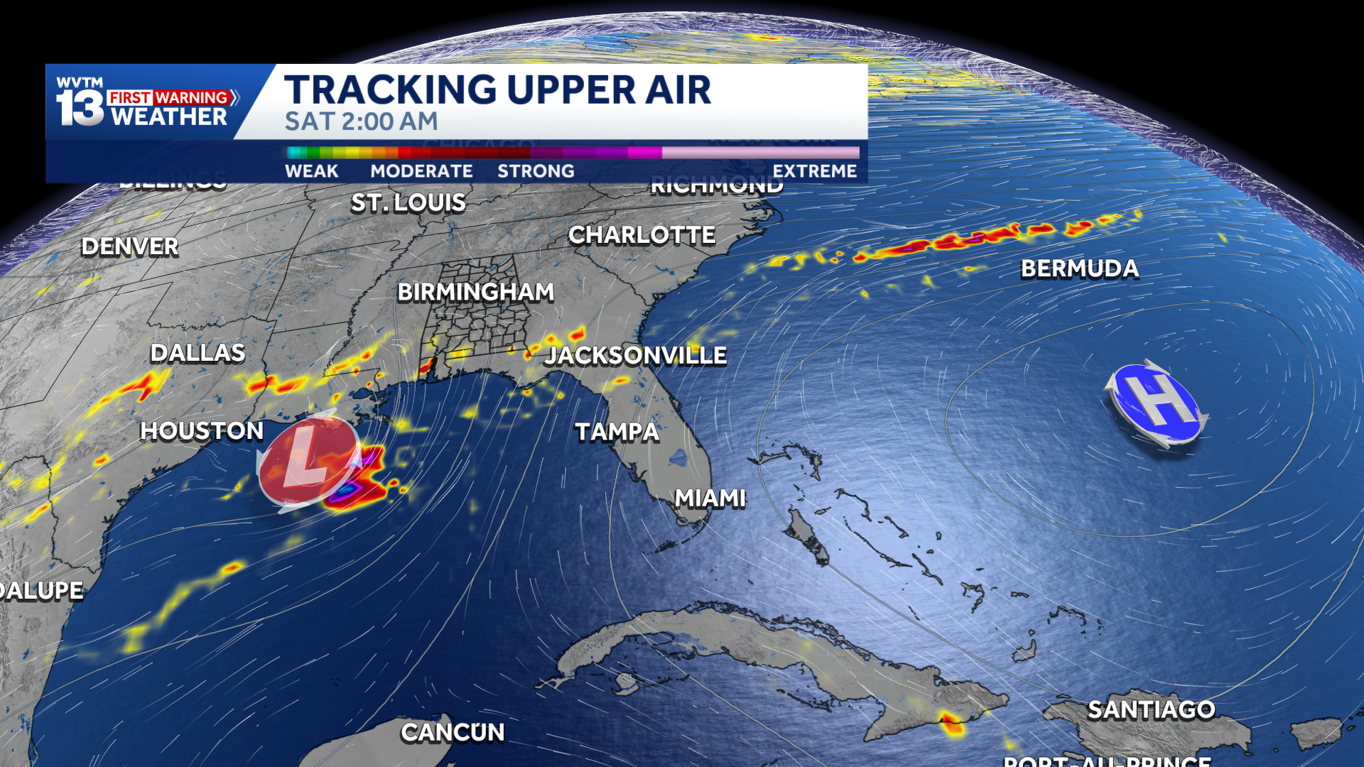
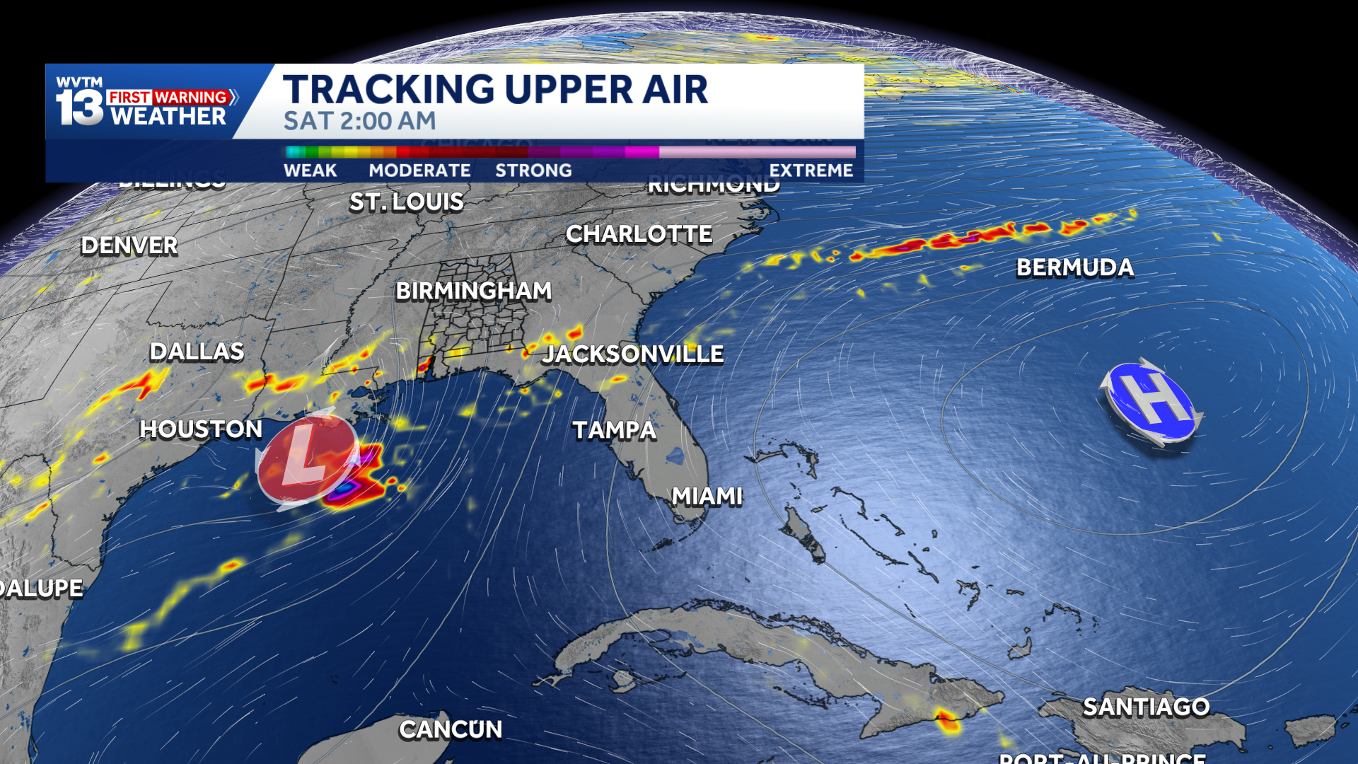
The National Hurricane Center is monitoring an area of disturbed weather driven by an upper-level low near the Bay of Campeche in the southwestern Gulf this week. While we cannot see clearly whether it will be a significant storm yet, the steering pattern will be in place to send it north by next weekend.
A tropical depression is likely to form during the middle or latter portion of the week. This system is expected to drift eastward over the next few days, before it turns northward.
Forecast models show the disturbance moving northeast toward the Gulf Coast Friday through Sunday, Oct. 9-11.
Until there is an organized system to track, forecasting its impacts will be nearly impossible. Even if it remains poorly organized, it could bring soaking rain to parts of the South this weekend. Whether that includes some or all of Alabama remains to be seen. In other words, do not cancel plans anywhere in the region just yet.
We will keep you posted with details as we move closer to the weekend.
MIDWEEK COLLEGE FOOTBALL
Troy hosting Southern Miss (Tuesday): A clear and pleasant evening is expected at Veterans Memorial Stadium for Tuesday’s 6 p.m. CDT kickoff. It will be comfortable with temperatures near 77 degrees at kickoff, falling into the upper 60s by halftime and cooling to around 63 degrees by the fourth quarter under a mostly clear sky.
Jacksonville State at Kennesaw State (Wednesday): It will be a cool, clear night for football just northwest of Atlanta as Jax State takes on Kennesaw State for Wednesday’s 6 p.m. CDT (7 p.m. EDT) kickoff at Fifth Third Stadium. Game-time temperatures will start around 72 degrees under mostly clear skies, dropping quickly into the low 60s around halftime and finishing near 57 degrees late in the second half.
WEEKEND OUTLOOK
The forecast for the upcoming weekend remains tricky, and much will depend on how the disturbance in the Gulf develops.
It will remain warmer than average regardless of the rain chances. Temperatures will rise into the 80s during the day and fall only into the 60s and 70s at night. The tropical influence will need to be tracked more precisely in the coming days. For now, we will include a chance of rain, with questions remaining about timing, amounts and which areas could receive the most.
NOAA’s Weather Prediction Center highlights that the threat of excessive rainfall and flash flooding for the Central Gulf Coast and Southeast, mainly due to heavy rain associated with this tropical disturbance.
There is still no truly chilly air in Alabama’s near future. Longer-range forecasts keep temperatures above normal for at least the next two weeks.
For 12 consecutive years, WVTM 13 First Warning Weather has been the source for the certified most accurate forecasts in Central Alabama, showcasing an unwavering commitment to delivering dependable weather updates.