
Alabama Weather Forecast: Cool fall mornings, hot afternoons
Summer heat and humidity return this week as rain chances build into the weekend
Afternoon highs climb, and overnight lows trend upward as we close out September and head into October. Humidity builds late in the week, too, bringing a better chance of rain as we move toward the weekend.
Check the video forecast for the latest updates.
7-DAY FORECAST
WEDNESDAY: A little more humidity nudges morning lows into the 60s. Highs climb into the lower 90s under mostly sunny skies. Rain chance: 0%.
THURSDAY: Partly cloudy, hot and more humid. Highs near 90. A few spotty showers or storms are possible, especially south of Birmingham, Tuscaloosa and Anniston. Rain chance: 10%.
FRIDAY: Clouds increase, with a good chance of showers and a few thunderstorms spreading across the state by afternoon and evening. Highs in the lower to middle 80s. Rain chance: 40%.
SATURDAY: Cloudy, with showers and a few storms at times. Highs in the upper 70s to lower 80s. Rain chance: 70%.
SUNDAY: Mostly cloudy, with occasional showers lingering across the state. Highs in the upper 70s to lower 80s. Rain chance: 80%.
MONDAY: Sun and clouds, with a few showers possible. Highs nearing the 80s and overnight lows in the 60s and 70s. Rain chance: 30%.
TUESDAY: Few clouds and a chance for a shower is possible. Highs in the upper 70s to lower 80s. Rain chance: 10%.
IT’S HOT… AGAIN!
On Tuesday, we topped out at 91 degrees, marking the 90th time we’ve reached 90 degrees this year. With much of Central Alabama expected to reach or exceed 90 degrees Wednesday and Thursday, we’ll likely add to that total.
Thursday stays hot, but a southerly flow will bring in more humidity, making it feel muggier. That added moisture will also set the stage for a much better chance of rain starting Friday and continuing into the weekend.
THE DOMINOES ARE FALLING
It has been a while since most of Alabama picked up measurable rain on the same day. Based on the statewide coverage analysis, the last time more than 90% of the state received measurable rain was June 19, 101 days ago. Before that, the previous widespread rain day was around Memorial Day, about four months ago.
This had a ripple effect on Alabama’s weather after the scorching hot August and September months leading to counties like Tuscaloosa, Bibb, Greene, Hale, Pickens counties to hit a moderate to severe drought.
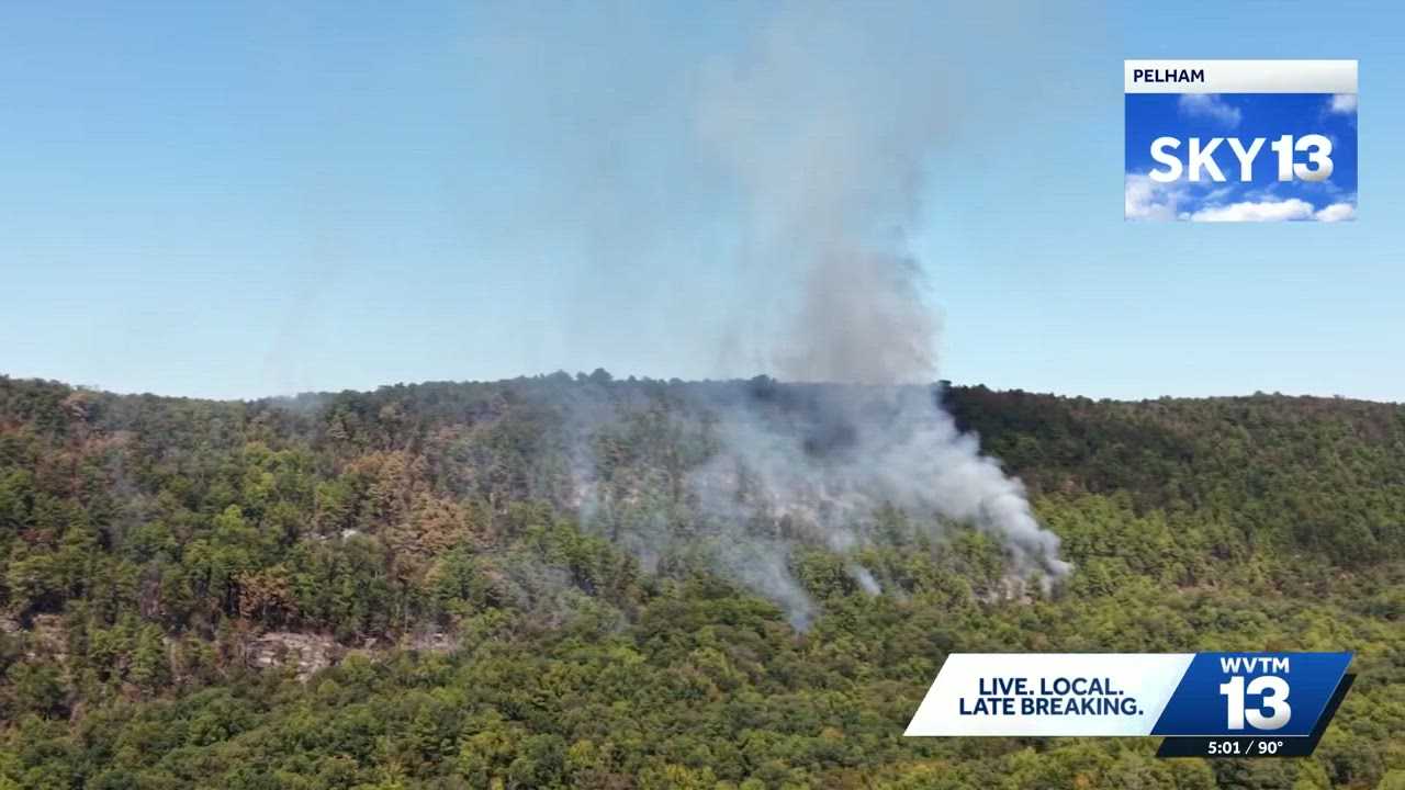
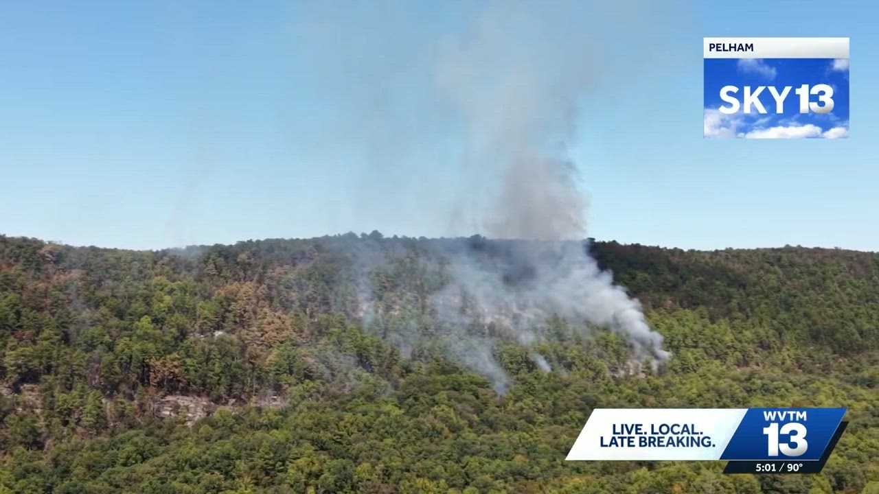
This also caused a brush fire at Oak Mountain, which started from a lightning strike last week, to spread beyond containment, leaving communities south and west of the preserve with a smoky start to the day.
We will keep monitoring as we go throughout tomorrow morning.
Now, for October, being in a drought is not too uncommon.
Based on climatology over the past 30 years, the probability of being in a drought like we are right now going into September is about 50%, essentially a coin toss, where some years could be wetter than others.
In fact, October is usually recorded as the driest month of the year. Most months average about 4 to 5½ inches of rain, while October averages only 3.34 inches.
October typically brings one good rainy day, not caused by a tropical system, with more than an inch of rain. Multiple rounds of heavy rain are uncommon, but this year, we might kick off the month with our one good rain day.
WEEKEND RAIN
We expect a good soaking is possible sometime between Friday and Sunday. Scattered showers are expected to develop Friday afternoon and continue into the evening. Not everyone will see rain, but some high school games could get wet, so have ponchos and rain gear handy!
An upper-level low and high pressure will bring tropical moisture from the Gulf ahead of a cold front to our northwest. The front looks to move our way over the weekend, and this setup will support scattered showers.
Current guidance gives most of the state a 50% to 80% chance of picking up at least an inch of rain through the weekend, with some areas possibly nearing 3 inches.
There is a slight risk of flash flooding Saturday, but we will continue to monitor the threat as we get closer to the weekend.
Based on what we see right now, the weekend will bring a few wet periods. Showers and storms look most widespread from Saturday afternoon through midday Sunday, with some improvement possible later Sunday.
We can’t pinpoint the exact timing of the most impactful rain quite yet. What we do know is that it won’t rain all day, everywhere, all at once. However, there will be a chance of rain this weekend, so grab an umbrella and have a backup plan just in case!
COLLEGE FOOTBALL WEATHER
Alabama at Mississippi State: Expect mostly cloudy skies and temperatures near 80 degrees for Saturday’s 11 a.m. CDT kickoff in Starkville. Rain chances start around 20% to 30% through the first half before climbing to near 50% by the end of the game. It will not rain the entire time, but packing a poncho is a good idea. A light east-southeast breeze is expected, with temperatures peaking near 81 degrees at halftime and settling near 80 degrees by the fourth quarter.
Auburn at Tennessee: Expect partly sunny skies for Saturday’s 2:30 p.m. CDT (3:30 p.m. EDT) kickoff in Knoxville. Neyland Stadium has a 30% to 40% chance of rain. A light northeast breeze around 5 to 8 mph is expected, with temperatures starting near 77 degrees at kickoff, slipping to 75 degrees at halftime and falling into the upper 60s by the fourth quarter.
UAB hosting Samford: Look for a mix of sun and clouds with warm conditions for Saturday’s 2:30 p.m. CDT kickoff at Protective Stadium, with a light east breeze around 5 mph. The rain chance is about 40% with spotty showers at best. Temperatures will start near 84 degrees, hold steady through halftime and drop into the mid-70s by the fourth quarter.
Miles College hosting Lane: Tailgaters will find mostly cloudy skies ahead of Saturday’s 2 p.m. CDT kickoff at Albert J. Sloan-Alumni Stadium. Fairfield has a 30% chance of rain with an east-southeast breeze under 6 mph. Any shower activity will be spotty, so a poncho probably will not be needed unless trends shift. Temperatures will start near 84 degrees at kickoff, and drop into the upper 70s by the end of the game.
For 12 consecutive years, WVTM 13 First Warning Weather has been the source for the certified most accurate forecasts in Central Alabama, showcasing an unwavering commitment to delivering dependable weather updates.