
Frost advisory issued as North Georgia temperatures drop

Saturday evening weather forecast
Brisk fall weather brings sunshine, gusty winds up to 30 mph, and highs in the 60s across North Georgia. A Frost Advisory takes effect from 1 to 9 a.m. Sunday as mountain lows drop near 30 degrees. Highs remain in the mid-60s Sunday before returning to the 70s next week.
ATLANTA – Crisp fall weather has settled firmly across North Georgia, bringing dry conditions, gusty winds, and the season’s first Frost Advisory as mountain temperatures dip toward freezing overnight.
Brisk weekend highs stay in the 60s
What we know:
An expansive area of high pressure settling over the Southeast has pushed a departing cold front into the Atlantic, leaving behind unseasonably cool, exceptionally dry air.
Saturday afternoon temperatures hovered in the lower 60s in Atlanta with sustained north winds of 13 mph, gusts up to 30 mph, and relative humidity plunging to 43%.
While the high-pressure system will maintain bright, sunny skies, it will also cause temperatures to tumble rapidly overnight.
Sunday afternoon will mirror Saturday’s conditions, remaining sunny and breezy with wind gusts lingering and afternoon highs topping out in the mid-60s.
First Frost Advisory active Sunday morning
Dig deeper:
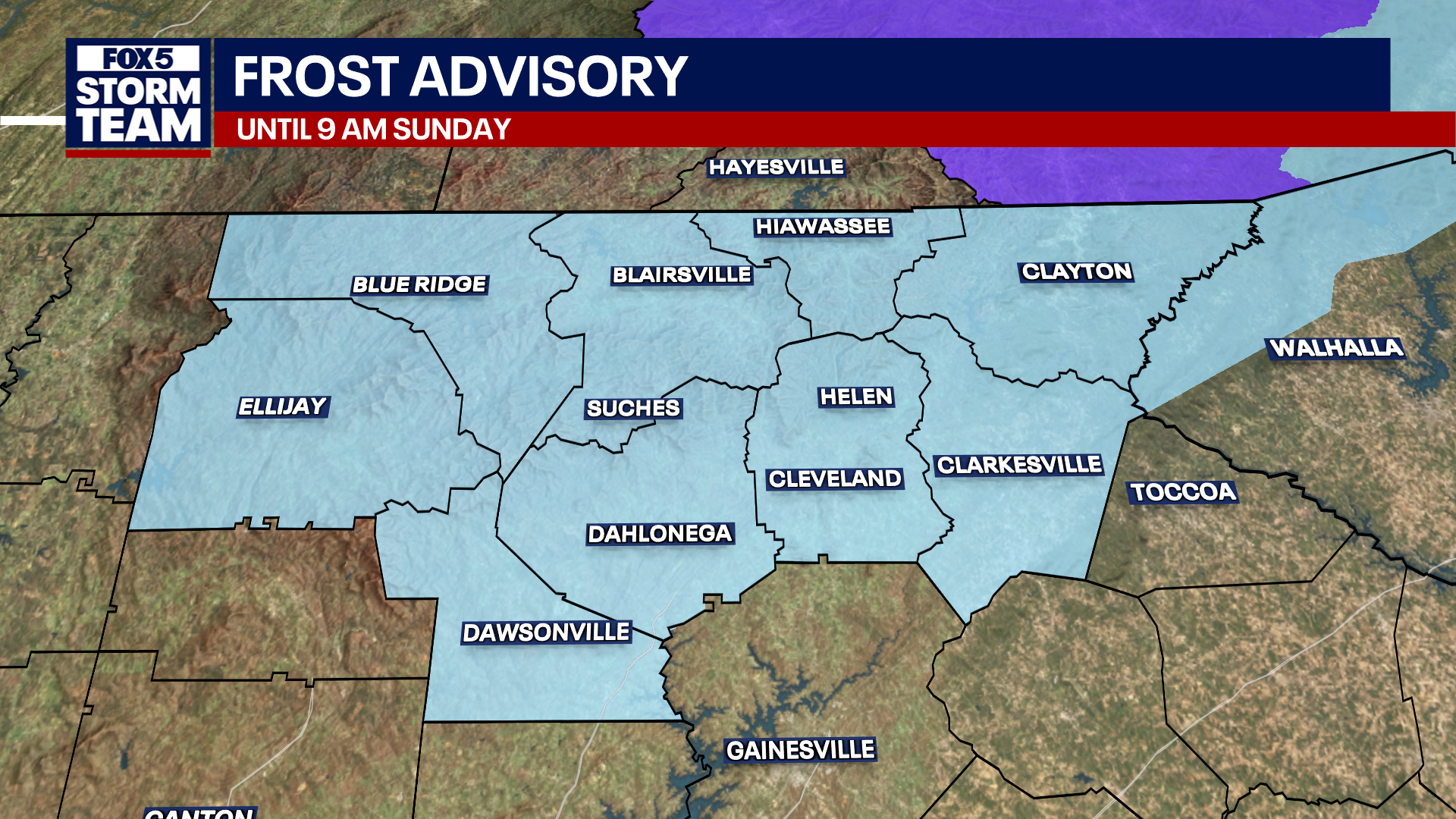
A Frost Advisory takes effect from 1 a.m. until 9 a.m. Sunday for higher-elevation mountain counties across North Georgia, where temperatures are expected to fall to near or below freezing.
The advisory covers nine Northeast Georgia counties: Fannin, Gilmer, Dawson, Union, Lumpkin, Towns. White, Rabun and Habersham counties.
Lows will plunge to 30 degrees early Sunday morning in Blairsville and Ellijay. Across the rest of North Georgia, morning lows will drop into the lower 40s to low 50s, while communities south of the metro area will start in the mid-50s.
Residents in the mountain counties covered by the advisory should bring potted plants indoors or cover outdoor vegetation that cannot withstand freezing temperatures.
What we don’t know:
It’s unclear whether patchy frost will extend down into lower-elevation northern metro suburbs over the next few nights.
Dry skies and a gradual warm-up next week
What’s next:
After a chilly, breezy Sunday with highs in the mid-60s, temperatures will begin a steady rebound.
Afternoon highs will reach the upper 60s by Monday before climbing back into the seasonable lower-to-middle 70s by midweek. Highs in the mid-to-upper 70s and dry, sunny conditions will persist through next weekend.
The Source: Information in this article was provided by FOX 5 Storm Team.